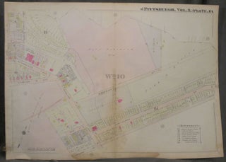
Plat Map of Pittsburgh, Including Part of Stanton Heights
Philadelphia: ca. 1900s. Paperback. ca. 1900s. Linen backed, 28 x 22 in. Good+. Folded once. Foxing to linen backing and along fold, else fine. Color map of the Stanton Heights area of Pittsburgh. Includes part of Stanton Avenue where it intersects with McCandless Avenue, along with Woodbine, Hawthorne, and a......