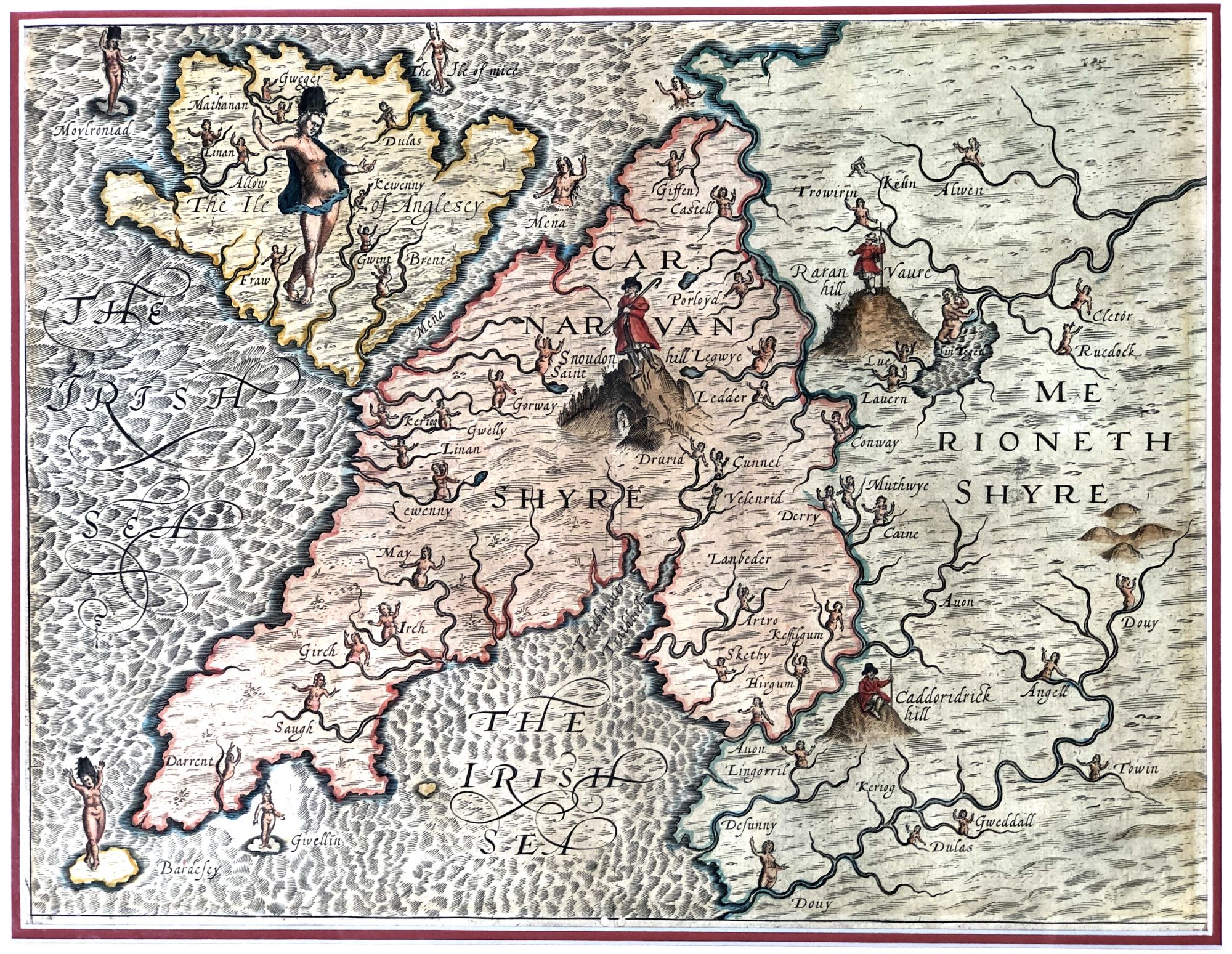
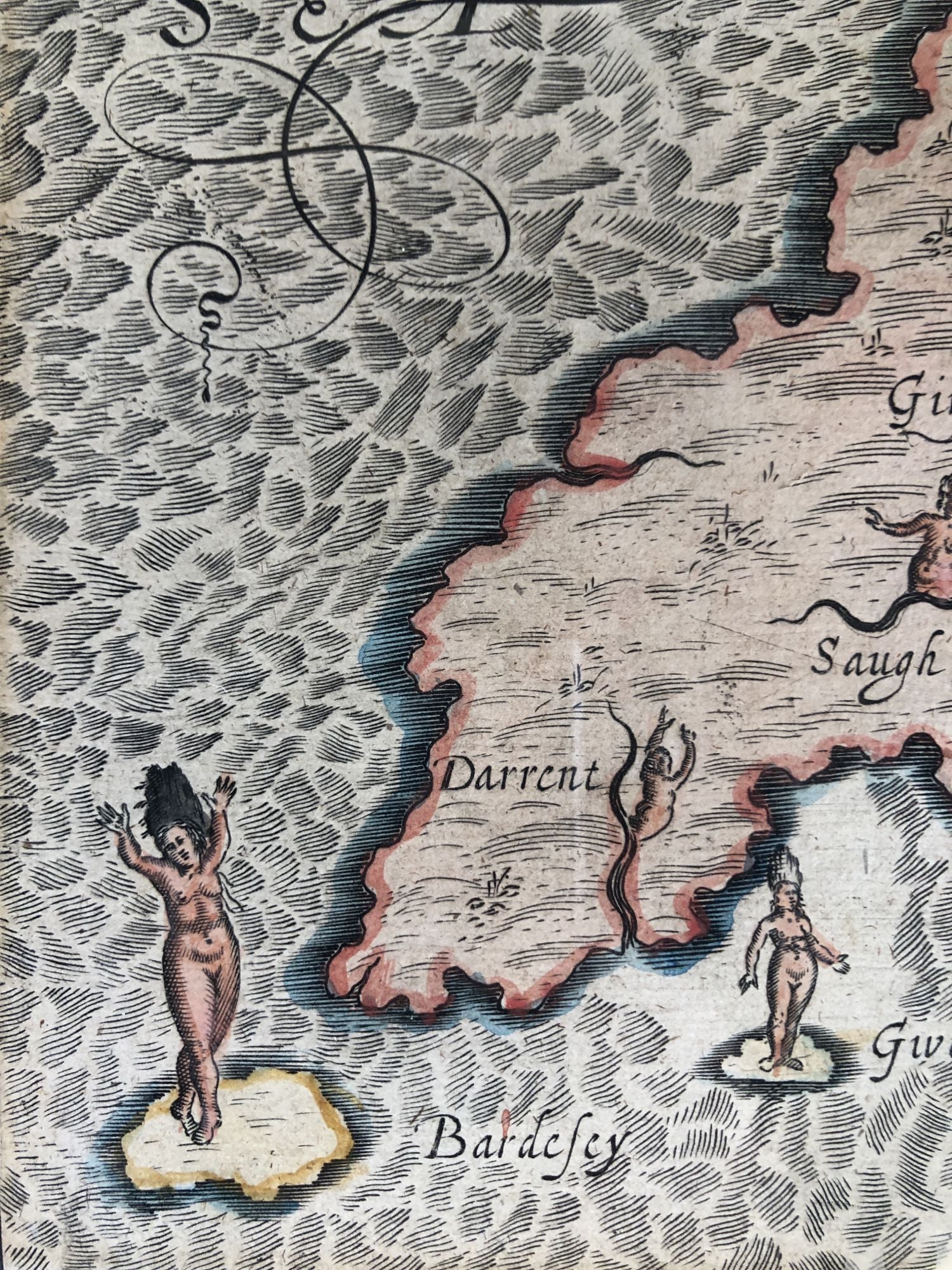
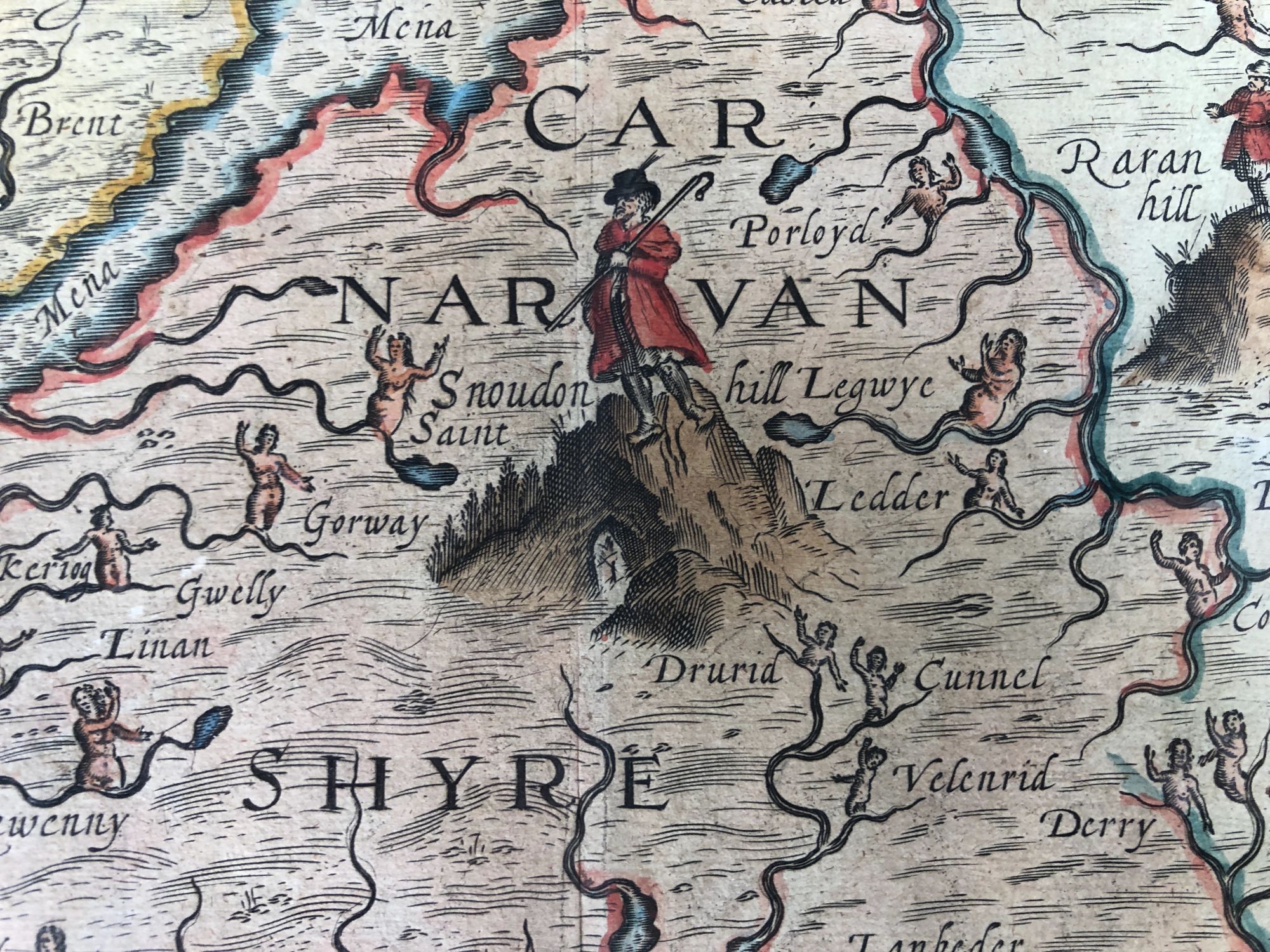

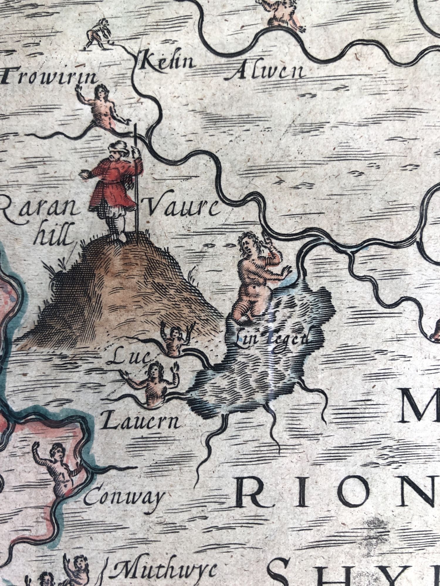
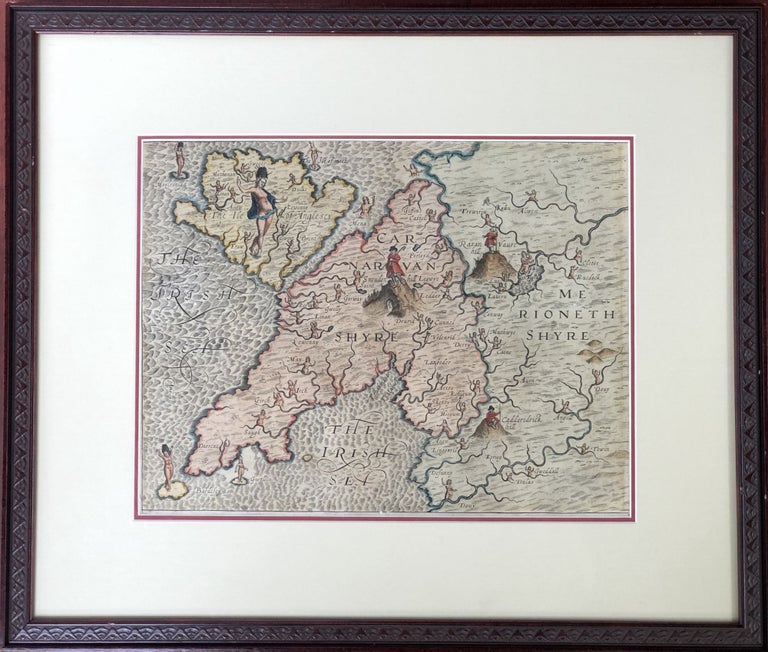
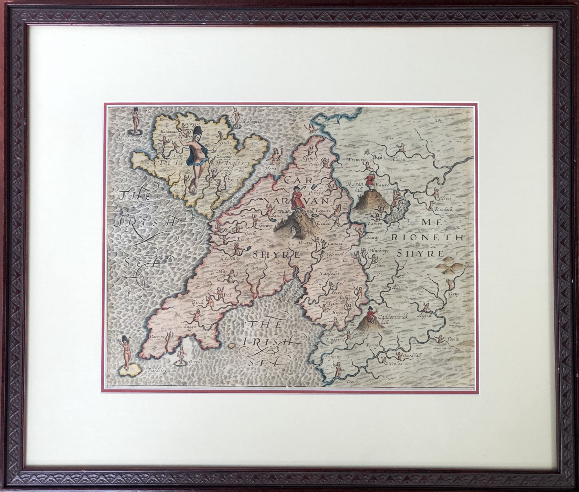
1612 allegorical map from Poly-Olbion: Carnarvanshire, Merionetshire, the Isle of Anglesey, Wales (1612)
A map from Drayton's "Poly-Olbion" published in 1612, with presumably contemporary hand coloring, 13 x 10 inches visible, handsomely double-matted, framed and glaze, to archival standards; not examined outside of frame. Shows the NW of Wales. Frame measures 20 x 17 inches. Fine. Item #H14132
Price: $250.00
See all items in
Maps & Cartography
See all items by Wales, Michael Drayton