
115 folding colored maps from PENNSYLVANIA ARCHIVES 1880s-1890s
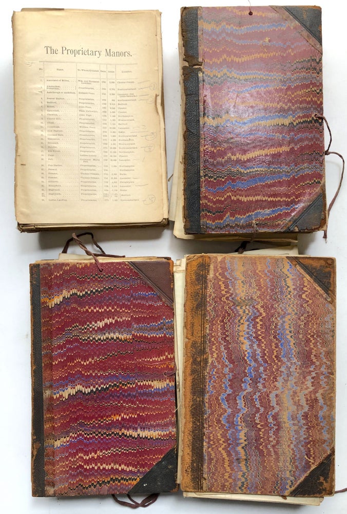
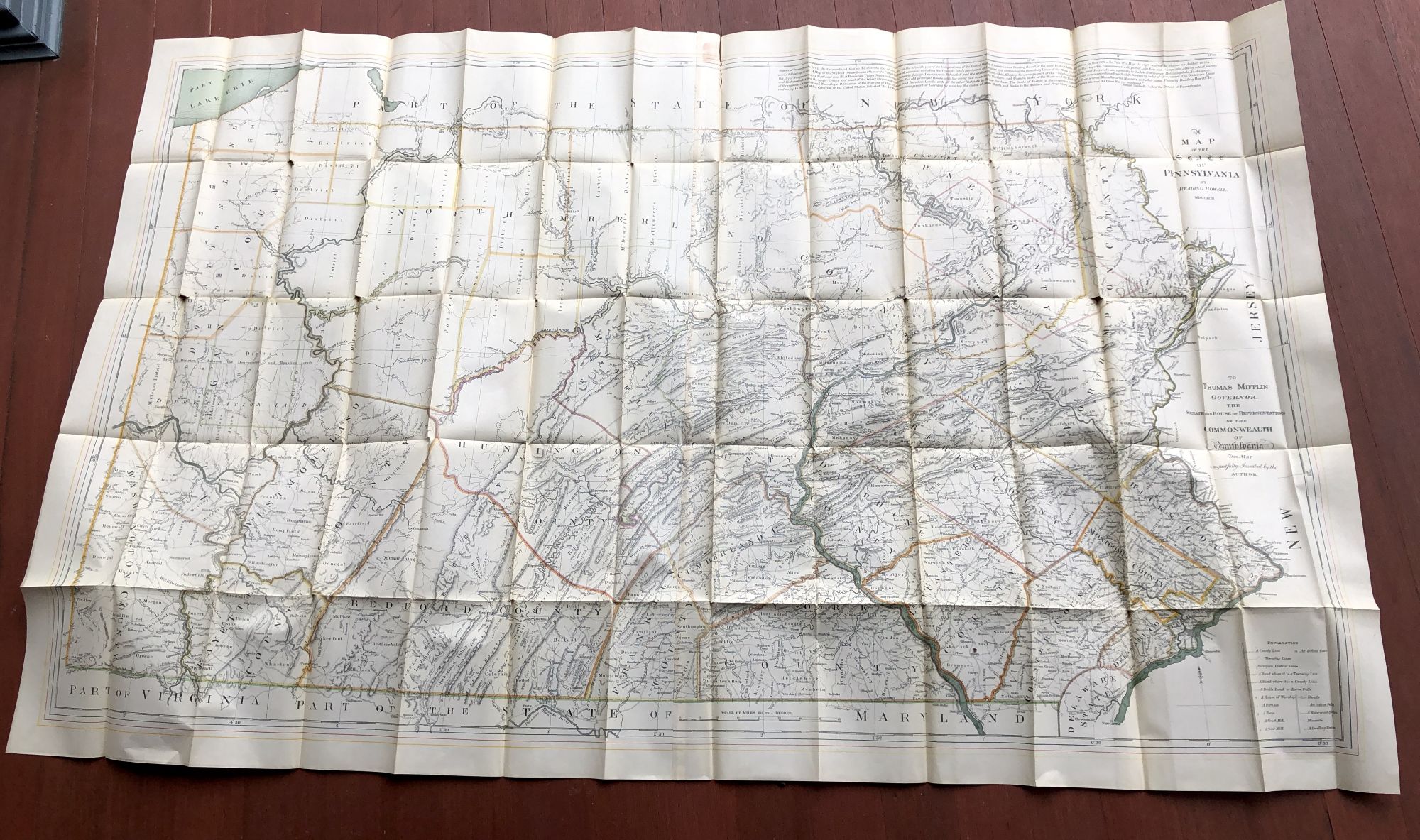
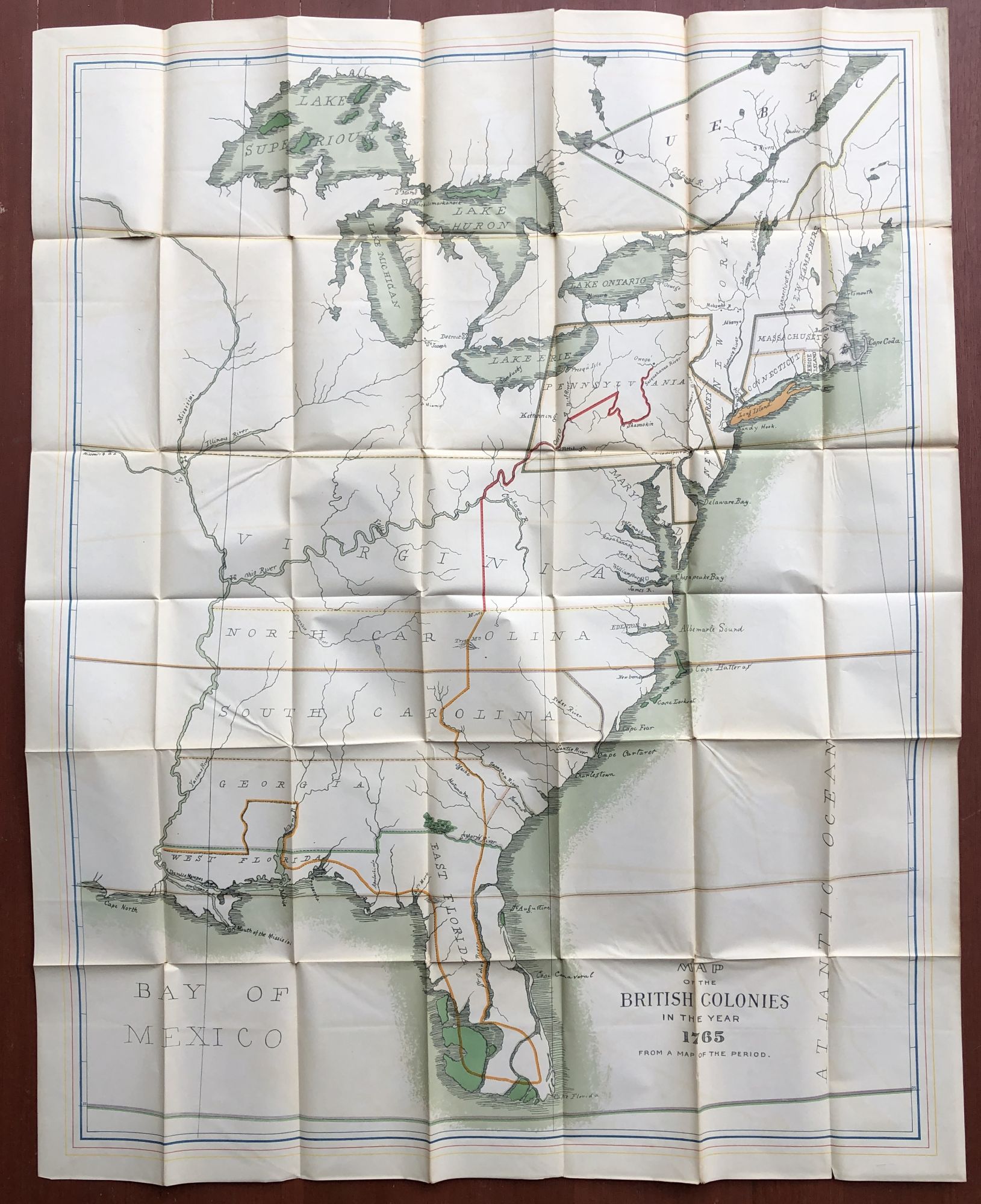
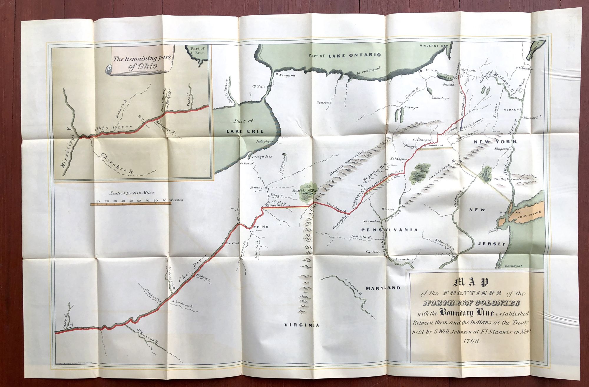
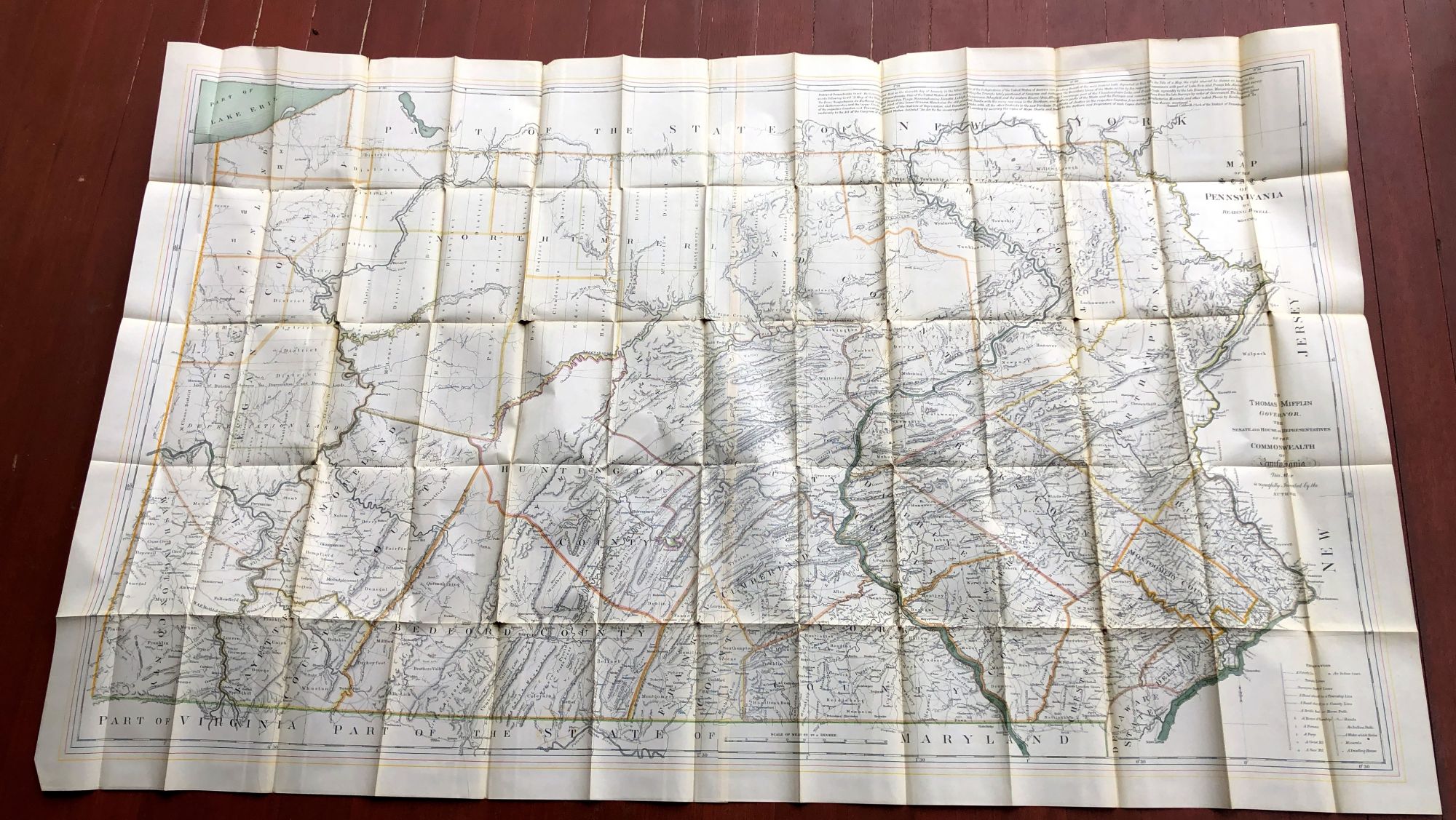
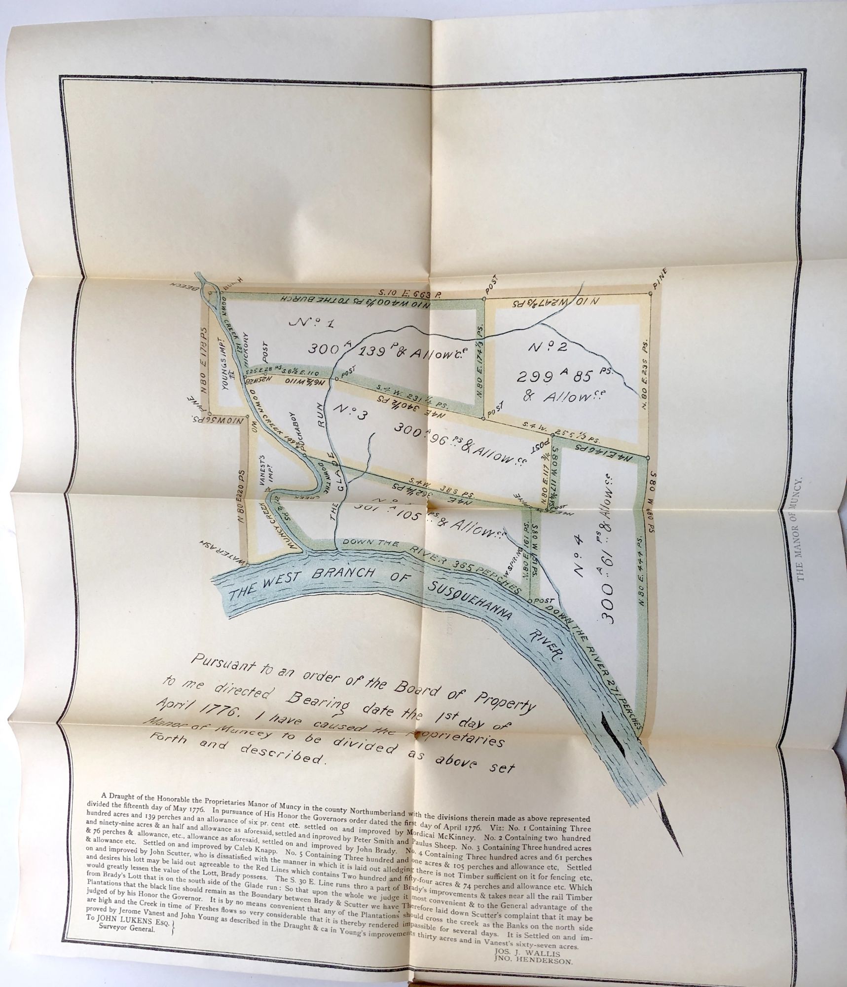
Harrisburg: Clarence Busch, 1880s-1890s. 69 loose folding maps, some very large, reproducing earlier maps or surveys from the 18th and early 19th centuries, all in very good condition with some tanning and darkening to folds and quite a few have small splits at the intersections of folds and separation at edges of folds, but we have not opened hardly any of them to check condition (sorry). 69 of the maps are loose, housed in original leather and marble boards, with spines gone; the other 46 are in a disbound volume from the 1890s of Proprietary Manors of Pennsylvania, reproducing surveys and other old maps of estates in counties across Pennsylvania. The maps are no doubt portfolios that would have accompanied select volumes in the substantial and multi-multi-volume Pennsylvania Archives series. Several may be duplicates. Not examined unfolded, although we have done so for several for the purposes of picture-taking, but clearly a bonanza for anyone interested in the early cartography of Pennsylvania and neighboring colonies (some of the series treat of Pennsylvania regiments that fought in the French and Indian wars, for example, that took them into New York, Ohio, &c. Very Good. Item #H14376
Price: $450.00