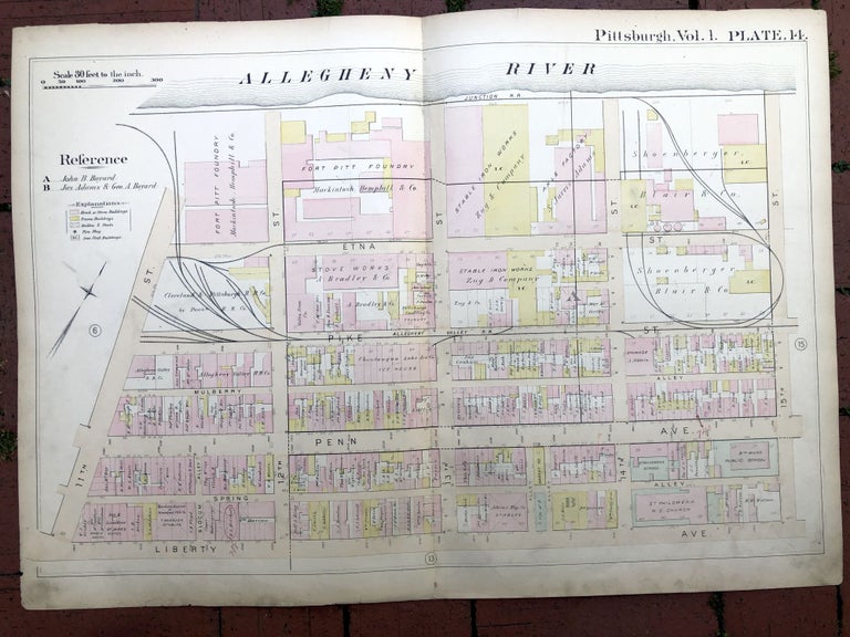
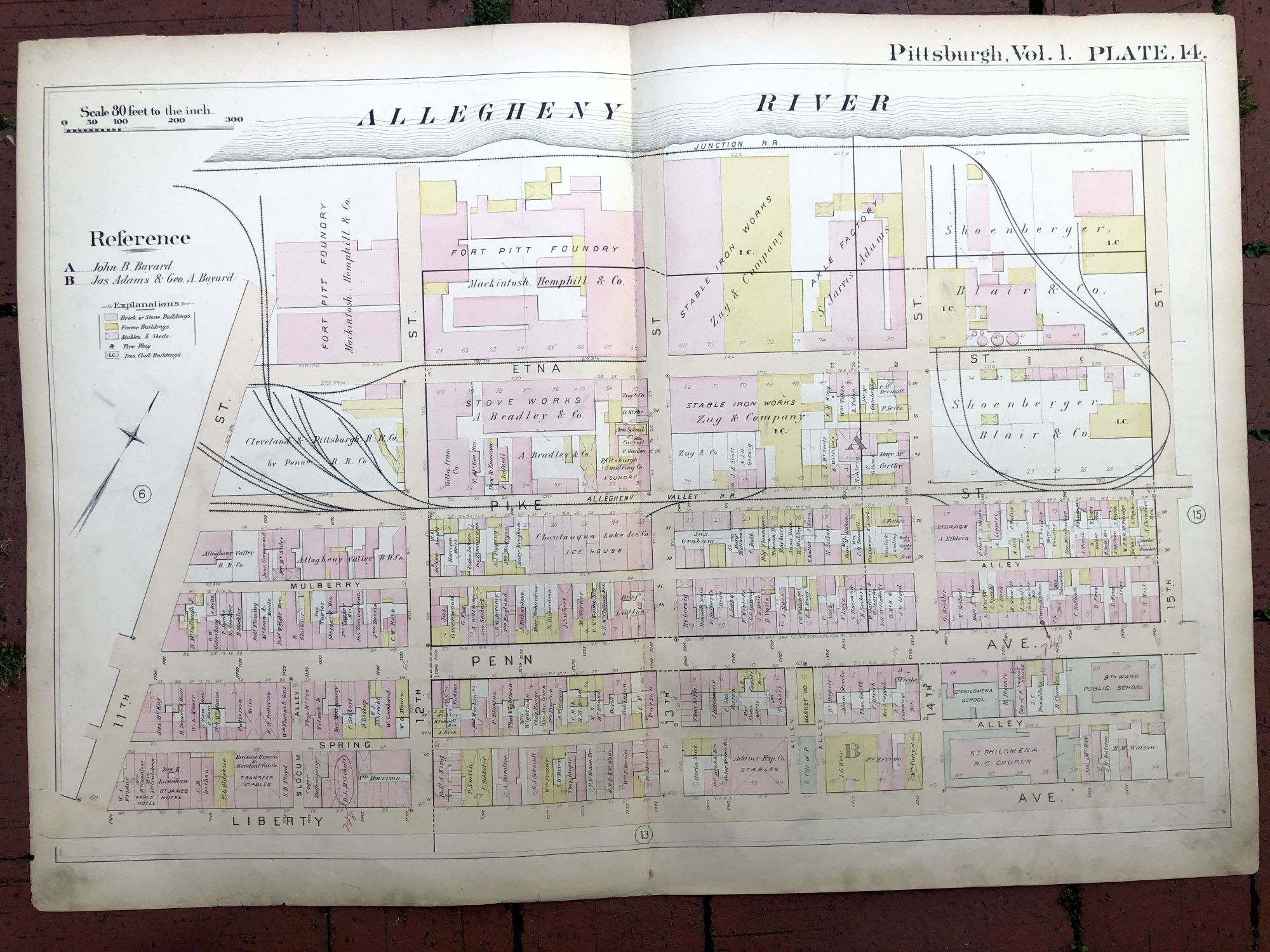
1889 large double-page color map of STRIP DISTRICT, Pittsburgh
Philadelphia: Hopkins, 1889. Map from "Atlas of the City of Pittsburgh, Vol. 1." Map measures 27.5 x 19 inches, very good, light edgewear and soil, light pencil notes and marks. Shows the area of the Strip District between 11th and 15th Sts. Very Good. Item #H17347
Price: $45.00
See all items in
Pittsburgh
See all items by Griffith M. Hopkins