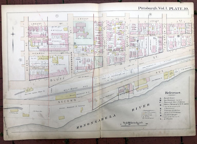
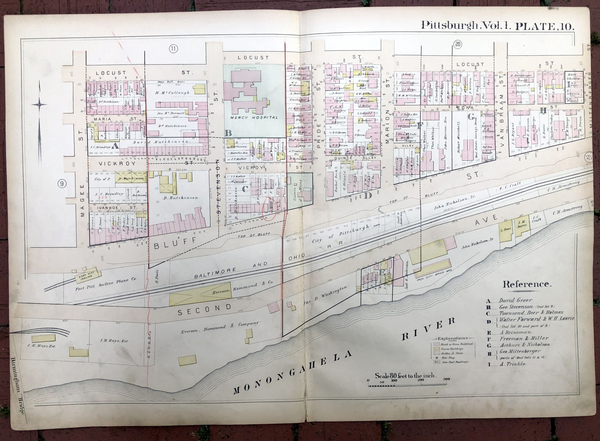
1889 large double-page color map of THE BLUFF (Duquesne University area), Pittsburgh
Philadelphia: Hopkins, 1889. Map from "Atlas of the City of Pittsburgh, Vol. 1." Map measures 27.5 x 19 inches, very good, light edgewear and soil, light pencil notes and marks, and some red pencilling as well. Shows part of the area above Second Ave. that used to be called "The Bluff" before the Boulevard of the Allies and the campus of Duquesne University. Very Good. Item #H17351
Price: $45.00
See all items in
Pittsburgh
See all items by Griffith M. Hopkins