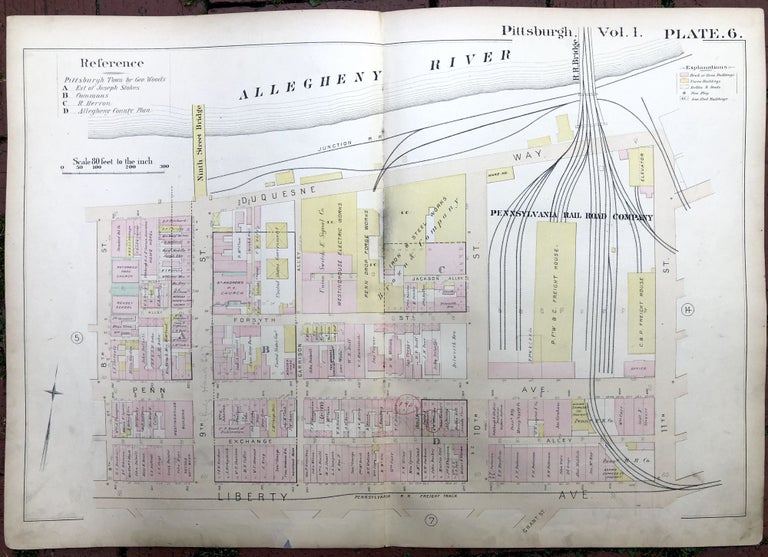
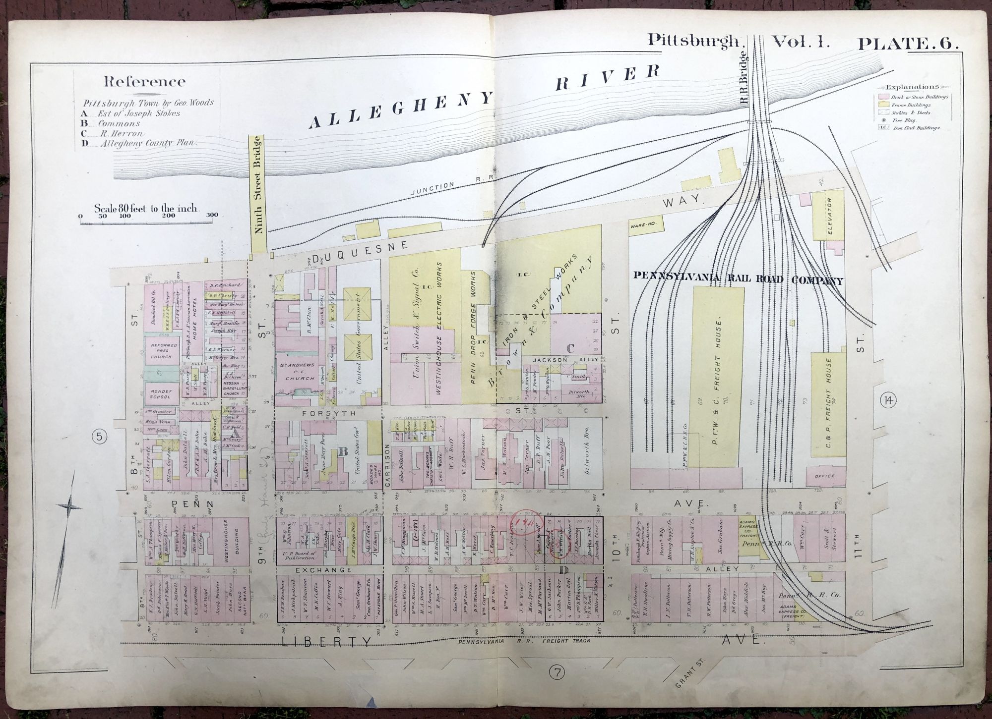
1889 large double-page color map of STRIP DISTRICT, Pittsburgh
Philadelphia: Hopkins, 1889. Map from "Atlas of the City of Pittsburgh, Vol. 1." Map measures 27.5 x 19 inches, very good, light edgewear and soil, light pencil notes and marks, small repair at bottom edge, and some red pencilling as well. Shows part of the Strip around 9th to 11th St. Very Good. Item #H17354
Price: $35.00
See all items in
Pittsburgh
See all items by Griffith M. Hopkins