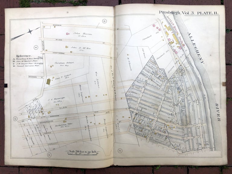
1890 large double-page color linen-backed map of MORNINGSIDE, STANTON HEIGHTS, Pittsburgh
Philadelphia: G. M. Hopkins, 1890. Handsome map from "Atlas of the City of PIttsburgh, Vol. 3...1890." 27.5 x 19 inches, linen backed, very good, light wear, toning and soil. Map shows the area of Morningside and parts of Stanton Heights, including Jancey, Chislett, Hawthorne, McKee, Woodbine, down to the Allegheny River. Very Good. Item #H17375
Price: $40.00
See all items in
Pittsburgh
See all items by G. M. Hopkins