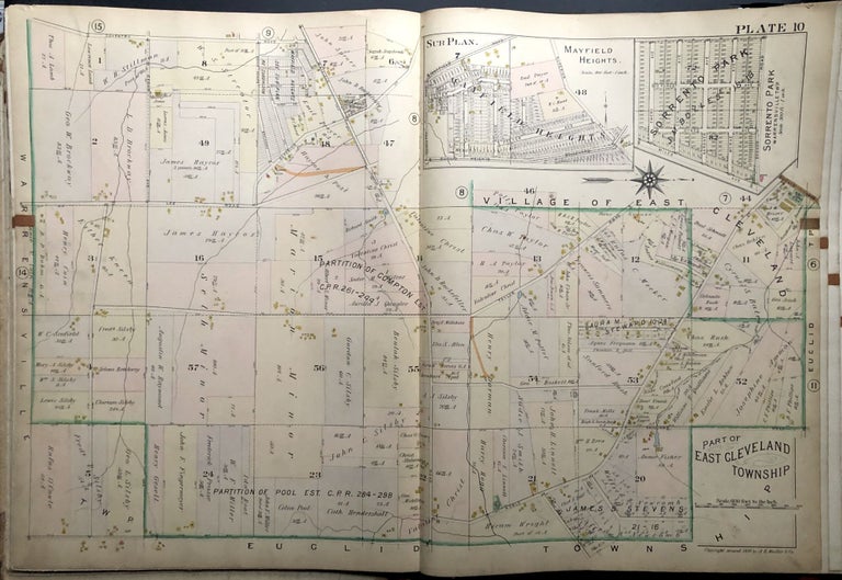
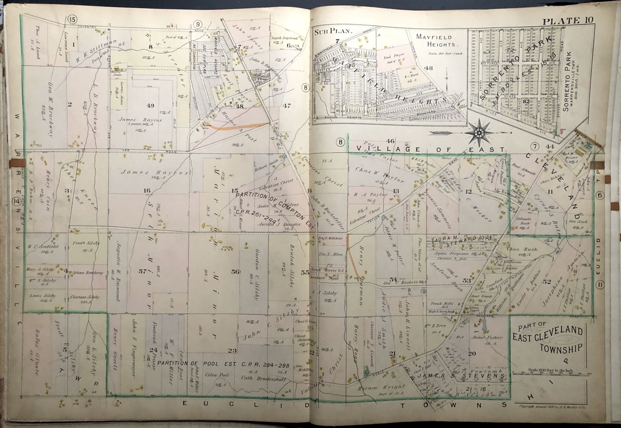
Part of East Cleveland Township, OH (Mayfield & Lee), 1898 linen-backed double-page color map 32 x 22"
Philadelphia: A. H. Mueller, 1898. Original map from "Atlas of the Suburbs of Cleveland, Ohio, Embracing Glenville, Collinwood, East Cleveland and South Brooklyn Villages; Newburgh, Lakewood and Rockport Hamlets; East Cleveland and Brooklyn Townships, and part of Euclid and Warrensville Townships" published in 1898. 32 x 22 inches, linen backed, in color. Very good, light wear, tanning and soil. This map shows the area with the intersection of two major roads: Mayfield and Lee. Very good. Item #H29050
Price: $75.00
See all items in
Ohio
See all items by Thomas Flynn