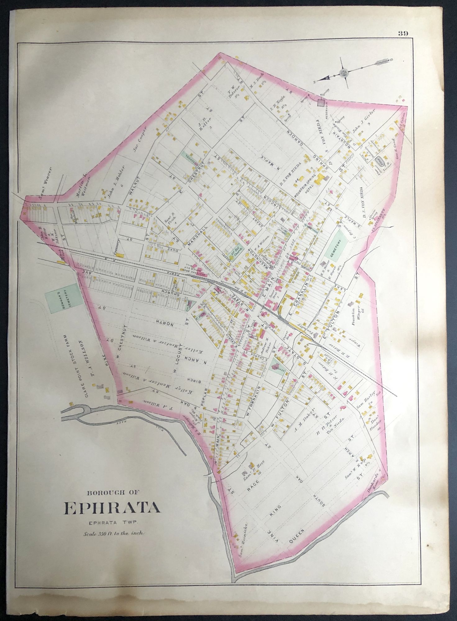
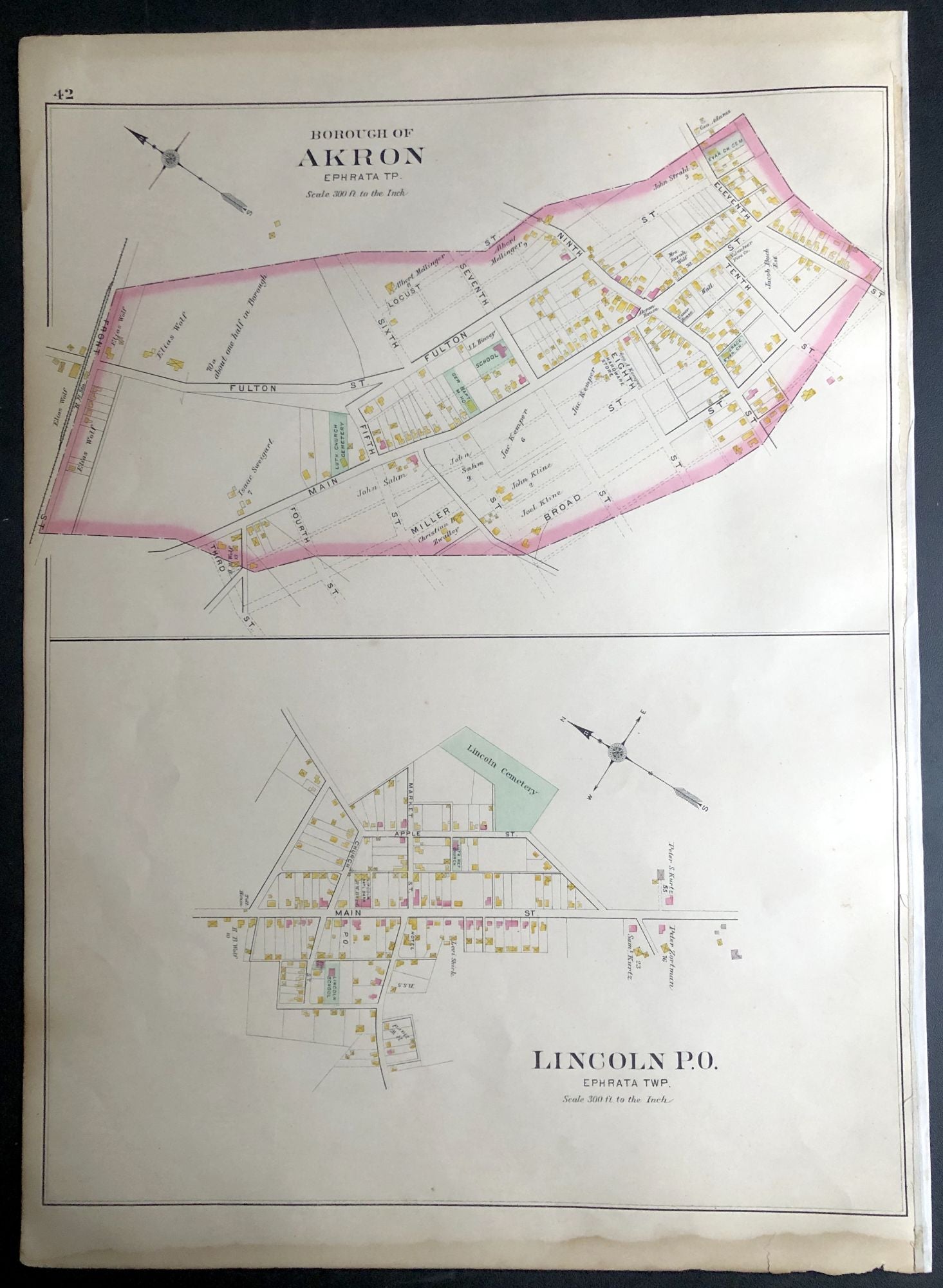
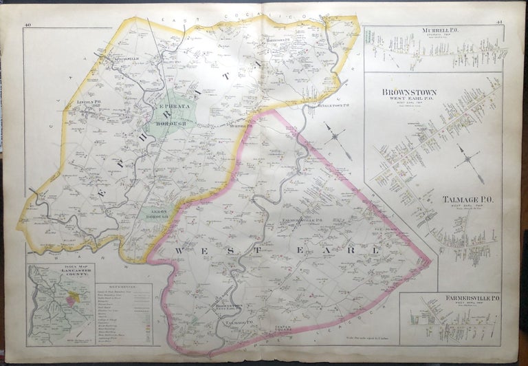
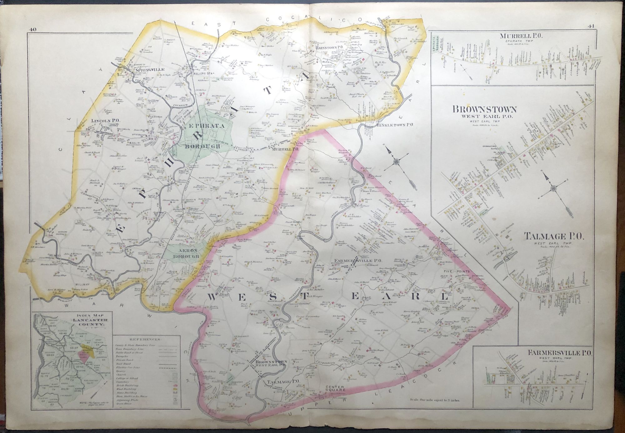
1899 33x22" color map: Ephrata, West Earl, Akron, Lincoln, etc., from Survey Atlas of Lancaster County, PA
Boston: Graves & Steinbarger, 1899. Large color map, when opened measures 22.5 x 33 inches; the double-page map shows Ephrata and West Earl with insets of Brownstown, Talmage and Farmersville, the versos showing the borough of Ephrata on one side, Akron and Lincoln on the other. Good with some edgewear, soil and light dampstaining along bottom edge. Good. Item #H29077
Price: $35.00
See all items in
Pennsylvania