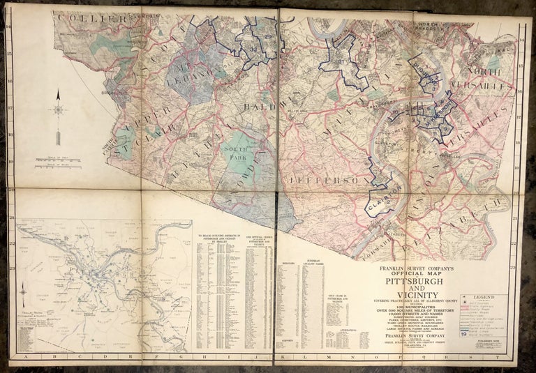
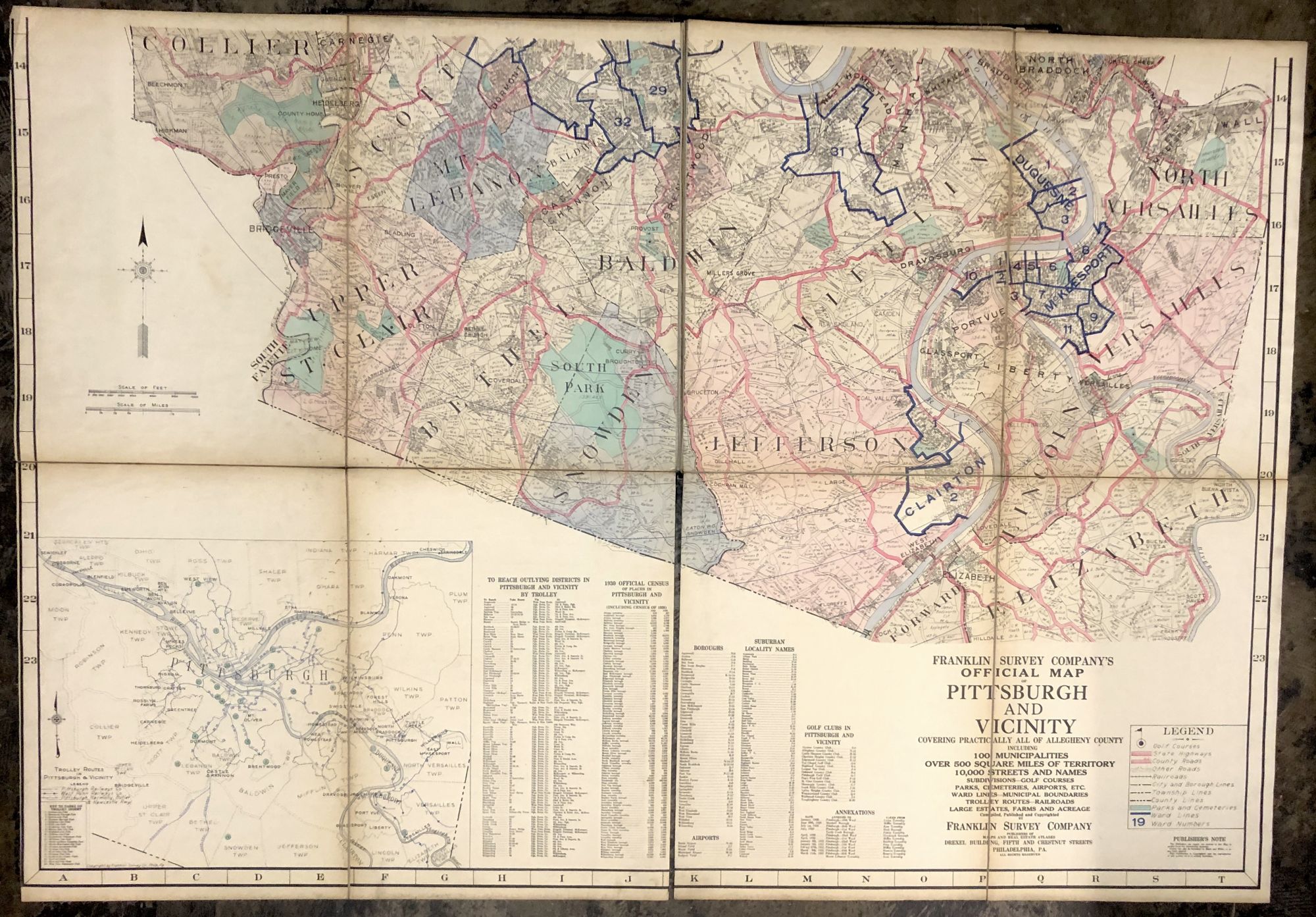
1931 56x80" linen backed Official Map of Pittsburgh & Vicinity, covering practically all of Allegheny County, including 100 municipalities, over 500 square miles of territory, 10,000 streets and names, subdivisions, golf courses, parks, cemeteries, airports, etc. ; ward lines, municipal boundaries, trolley routes, railroads, large estates, farms and acreage
(Philadelphia): Franklin Survey Company, Ca. 1931. Hardcover. A huge and rare map, in 4 maps, each composed of 4 panels, each of the four maps measuring 28 x 40" -- the total area of the map, if all 4 quadrants were put together, would be 56 x 80 inches. In cloth binding that is somewhat shelfworn and with recent cloth over spine, the maps are in very good condition, light soil and toning, especially to margins. Extremely uncommon with OCLC locating only 2 holdings: University of Chicago & Penn State. They are dated 1933 and 1931; there's no date on the maps themselves we could find, so we're taking it on faith that one of those dates on OCLC is correct. Includes the South Hills and the North Hills. Good. Item #H29624
Price: $375.00