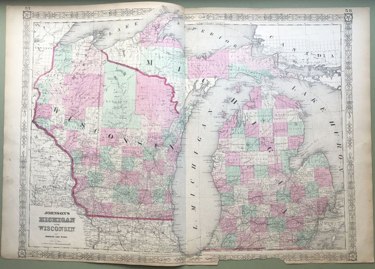
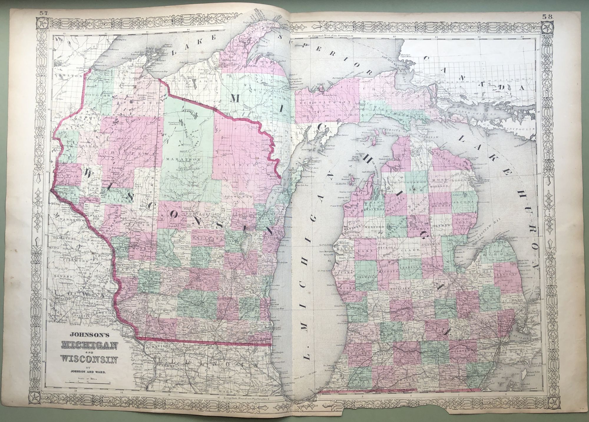
1864 Johnson's map: MICHIGAN & WISCONSIN, 26 X 18
New York: Johnson and Ward, 1864. Original map from the 1864 Johnson's New Illustrated (Steel Plate) Family Atlas; the single page maps measure 18 x 13.25 inches wide, the double page ones are 18 x 26.5 inches. This map has some age toning and light wear and soil and 4 inches of loss to lower decorative border. Good. Item #H8518
Price: $20.00
See all items in
Maps & Cartography
See all items by Johnson