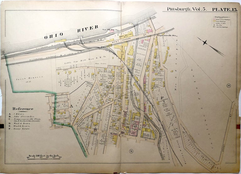
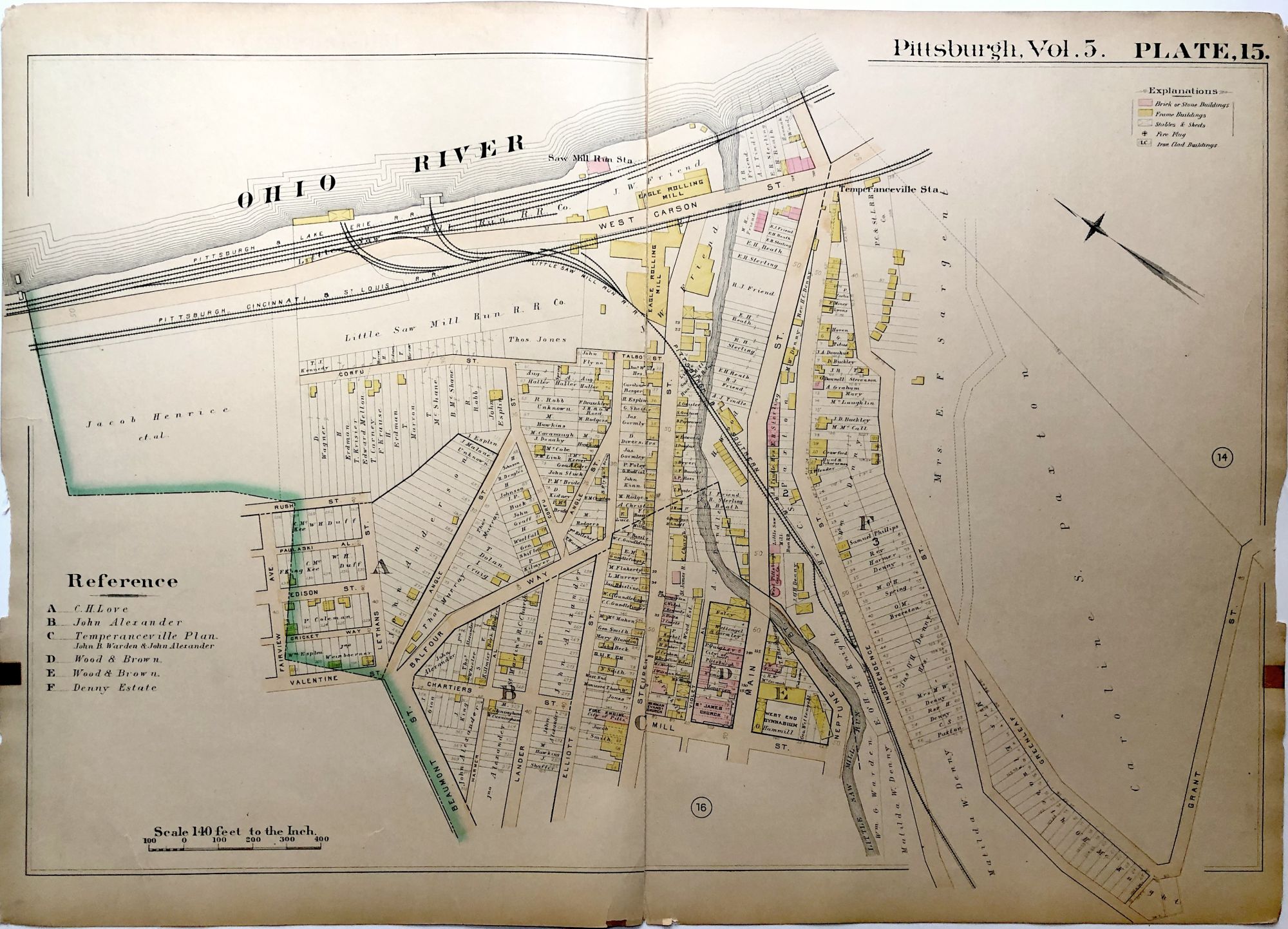
1890 linen backed map 27 x 19.5" Pittsburgh West End
Map from "Atlas of the City of Pittsburgh, Vol. 5...24th to 36th Wards" -- this one is of the West End neighborhood, West Carson, Temperanceville Station, Steuben St, Main St. Some wear including shallow chipping to left and right edges and bit of wear to bottom edge near center fold. Item #H8910
Price: $35.00 save 33% $23.45
See all items in
Pittsburgh