
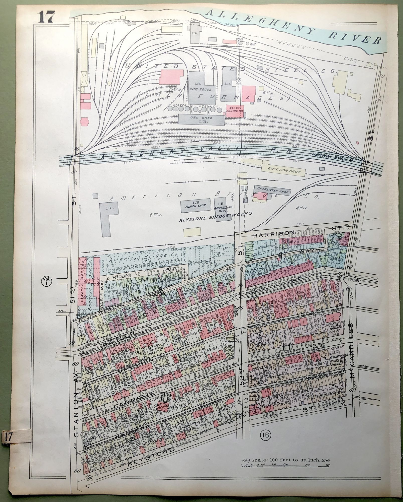
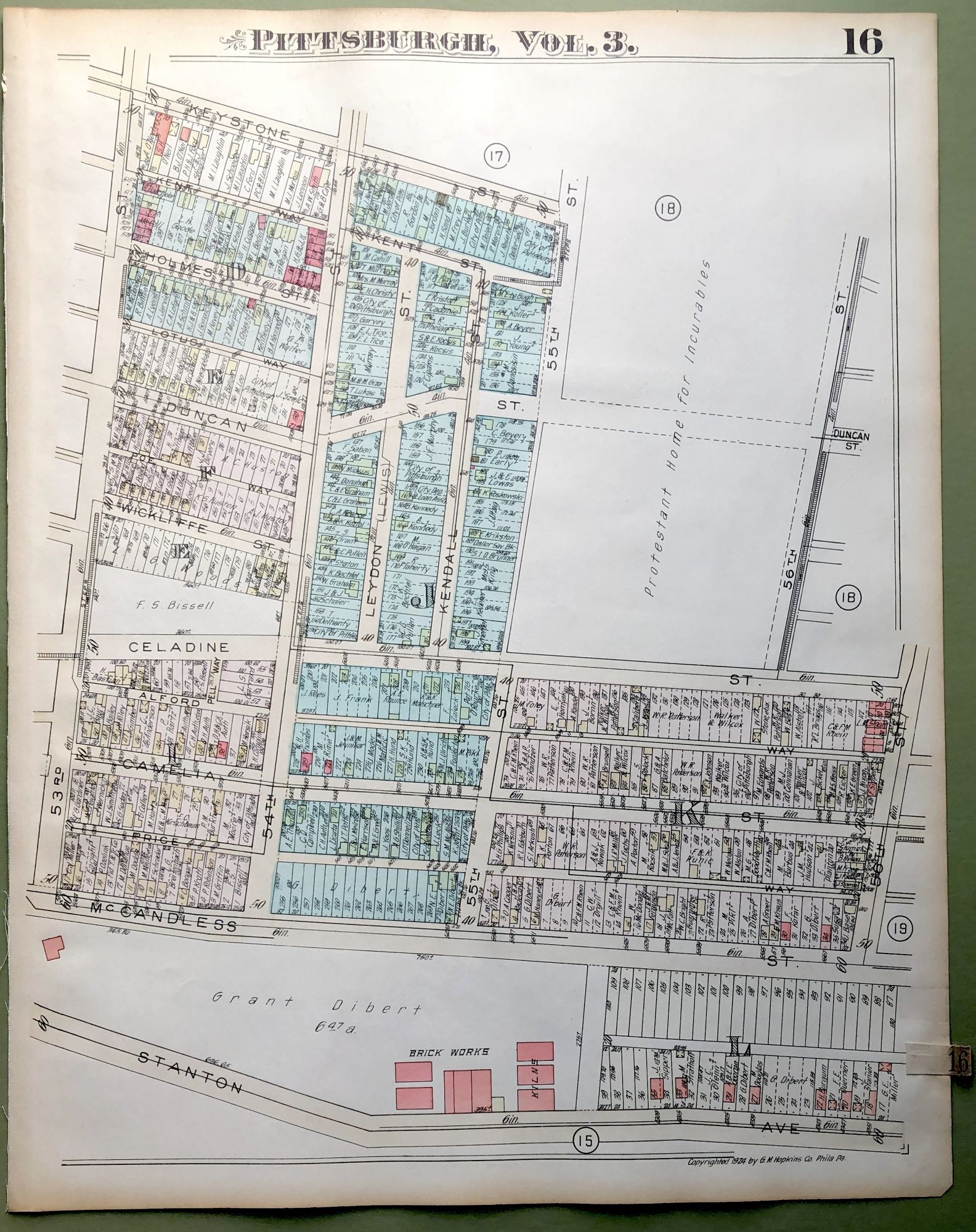
1924 Pittsburgh Plat Map 23x18: Stanton Heights, West
Philadelphia: G. M. Hopkins, 1924. From 'Real Estate Plat-Book of the City of Pittsburgh, Vol. 3. Comprising the Wards 8, 10, 11, 12 & 13.' Double sided map. VG with light wear and soil. Item #H9121
Price: $35.00
See all items in
Pittsburgh