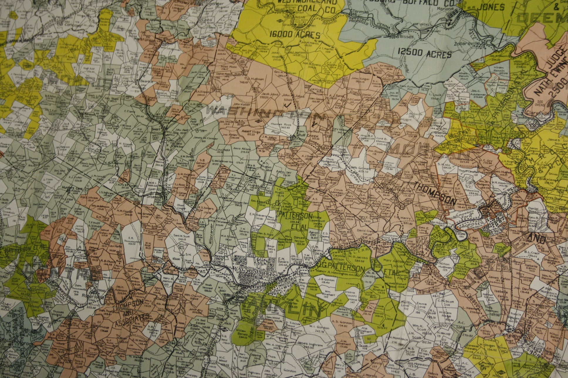
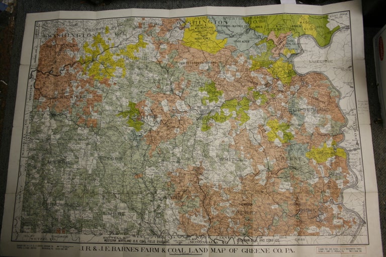
J.R. & J.E. Barnes Farm & Coal Map of Greene Co. PA: Compiled from Coal Surveys & U.S. Topographical Sheets
Uniontown, PA: Barnes, 1907. First printing. Paperback. 1907 Cloth backed folded map, loose, 32 x 44.5 inches. Four-color lithograph labelling all farms and coal fields in Southwest PA, including the owners' name. Two pencil notations indicate the prices and purchasers for which parcels were sold after the publishing of the map, dated 1909. The map is in VG+/NF condition, bright and clean, with no tearing. Minimal edgewear, generally a nice, crisp copy of this very handsome, scarce map, with no copies registered in OCLC. Very Good +. Item #z03457
Price: $126.00
See all items in
Maps & Cartography,
Western Pennsylvania
See all items by Richard Smith