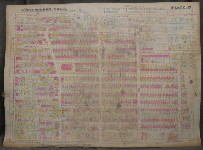
Plat Map of the Homewood Neighborhood in Pittsburgh
Philadelphia: ca. 1900s. Paperback. ca. 1900s. Linen backed, 32x 23 in. Good+, with heavy foxing to linen back that is visible on the front and finger smudging to extremities of map. Despite the smudging, all details remain legible. Color map of the Homewood neighborhood of Pittsburgh. Encompasses the areas between Murtland and Collier Avenues, and between Chaucer/ Spraug Street and Franklin Avenue, with Lang, Homewood Avenue, and other major streets labeled. Homes and businesses are identified and labeled, among them Belmar School and Homewood United Presbyterian Church. Map housed in protective plastic. Good+. Item #z07843
Price: $26.25
See all items in
Maps & Cartography,
Pittsburgh
See all items by Homewood Pittsburgh, Map