
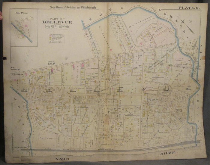
Plat Map of the Northern Vicinity of Pittsburgh, Including Part of Bellevue
Philadelphia: ca. 1900s. Paperback. ca. 1900s. Linen backed, 28 x 22 in. Good+. Folded once. Foxing to linen backing and bottom corners, finger smudging to extremities and offsetting from index tab, else fine. Color map includes parts of Bellevue, bordered by railroads and the Ohio River, and a sliver of Ross Township. Tracts of land are labeled by owner and acreage. Homes and businesses are also identified. good+. Item #z07853
Price: $26.25
See all items in
Maps & Cartography,
Pittsburgh
See all items by Pittsburgh Map, Bellevue