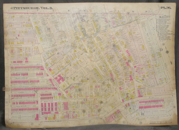
Plat Map of Pittsburgh, Including Part of Homewood
Philadelphia: ca. 1900s. Paperback. ca. 1900s. Linen backed, 32 x 23 in. Good+. Folded once. Foxing to linen backing visible on front, though all details of the map are still legible. Aging to extremities, else fine. Color map of the Homewood neighborhood of Pittsburgh (Penn Township). Map extends between Collie and Singer Streets/ Frankstown and Prague streets. Parts of Braddock Avenue, Ferndale, Lawndale, and other streets are labeled, along with homes and businesses. Housed in protective plastic. good+. Item #z07856
Price: $26.25
See all items in
Maps & Cartography,
Pittsburgh
See all items by Pittsburgh Map, Homewood