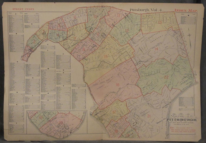
Plat Map Street Index of Wards 16, 20, 22, and 23 of Pittsburgh: Including Oakland, Shadyside, Wilkinsburg, Squirrel Hill, Hazelwood, Greenfield, and the East End
Philadelphia: 1890. Paperback. 1890. 27 x 19 in. Very good. Folded once. Chipping to corners and extremities, with a couple one inch tears to top edge, else fine. A color street index map encompassing Wards 16, 20, 22, and 23 of Pittsburgh. This includes parts of Oakland, Shadyside, Squirrel Hill, Hazelwood, Bloomfield, Lawrenceville, and many other neighborhoods. The street index alphabetically lists street names and plate locations. Very Good. Item #z07857
Price: $45.00
See all items in
Maps & Cartography