
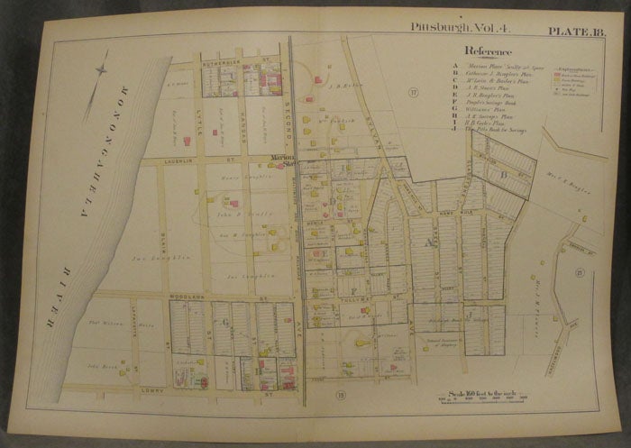
Plat Map of Pittsburgh, Including Parts of Greenfield
Philadelphia: 1890. Paperback. 1890. 27 x 19 in. Very good. Folded once, some chipping to extremities, else fine. Color map includes part of Greenfield in Pittsburgh. Extends between the Monongahela River and Hazelwood/ Rutherglen and Lowry. Second, Woodlawn, Sylvan, and Lytle are also included. The Baltimore and Ohio Railroad and other landmarks are labeled. Very Good. Item #z07877
Price: $33.75
See all items in
Maps & Cartography,
Pittsburgh
See all items by Pittsburgh Maps, Greenfield