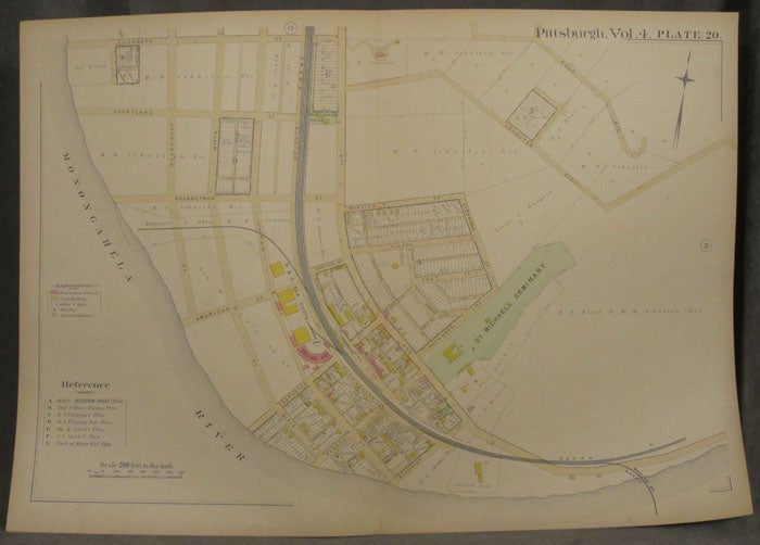
Plat Map of Pittsburgh, Including Parts of Hazelwood
Philadelphia: 1890. Paperback. 1890. 27 x 19 in. Very good. Folded once, some chipping to extremities, else fine. Color map includes part of Hazelwood in Pittsburgh. Bordered by the Monongahela, and includes part of Second, Elizabeth, and Johnston. The Baltimore and Ohio Railroad, St. Michael's Seminary, and other landmarks are labeled. Very Good. Item #z07879
Price: $33.75
See all items in
Maps & Cartography,
Pittsburgh
See all items by Pittsburgh Maps, Hazelwood