Historical Atlas of Kansas
Norman: University of Oklahoma Press, 1988. Paperback. Second edition. Quarto, wraps, clean unmarked text, near fine copy.
Norman: University of Oklahoma Press, 1988. Paperback. Second edition. Quarto, wraps, clean unmarked text, near fine copy.
Philadelphia: Published by the author, 1829. First printing. Hardcover. First edition, 1829. 8vo, contemporary half red morocco gilt, marbled boards, very good copy, light wear, very small hole to terminal blank and rear flyleaf, text slightly wavy but no evidence of damp staining, front pastedown has old bookplate of John.....

Wolfeboro Falls, NH: Sutton Pub LTD, 1990. First American edition. Hardcover. 1990 Hardcover, with Dust Jacket. Condition rates as Fine, in a Near Fine Dust Jacket that shows light shelf wear.
Pittsburgh, PA: The Engineers' Society of Western Pennsylvania, 1930. First edition. Hardcover. First Edition. c.1930. Hardcover. 416pp. Illustrated with many black & white photographs and several fold-out maps. Near Fine. Mild wear to boards, light rubbing to corners and spine-ends, very light soil to edges, former owner's signature and address.....
Dublin: Royal Irish Academy, 2005. First edition. Folio. in pictorial wraps. 47pp. plus 30 plates, photographic and topographical, including a folding map. Very good. Light edge wear and scuffing to wraps, some penciling to contents, else clean and unmarked. Large item will require extra postage.
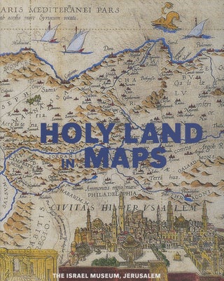
Jerusalem: The Israel Museum, 2001. First edition. Hardcover. 2001, First Edition. Hardcover. Illustrated. 168 pp. English text. A bright, sharp, clean copy in dust jacket.
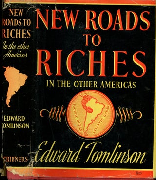
New York: Charles Scribner, 1939. Later printing. Hardcover. 1939. Later printing. Hardcover, 8vo. in red cloth, with gilt title and map endpapers, in dust jacket. 438pp. frontis, illustrated with photographs. Very good in good dust jacket. Chipping and heavy loss to dj spine ends. Chipping to dj extremities and splitting.....
Amsterdam: Elsevier, 1968. Hardcover. 1968. Hardcover, tan cloth, folio (9 x 17 inches). 276 pp. Illustrated throughout, including numerous fold-out maps. Fine copy in a Very Good dust jacket that has some light soil and edge tearing. A nice copy. Due to the size of this book international orders will.....
Amsterdam: Elsevier, 1968. Hardcover. Hardcover with beige cloth boards in dust jacket, 1968, folio, 276pp., illustrated with fold out maps in color and some in b&w. Book VG+ with some toning and soil around edges of boards, binding tight, text clean and unmarked, with foxing to edges of text block.....
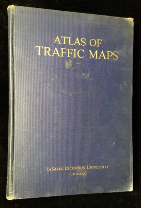
Chicago, IL: LaSalle Extension University, 1930. Reprint. Hardcover. Gilt stamped blue cloth boards, large octavo [7.75" x 11"], illustrated with color and b&w maps. Book has soil and rubbing to boards and spine, corners and spine ends worn and torn, binding tender but holding, text clean and unmarked but toned.....
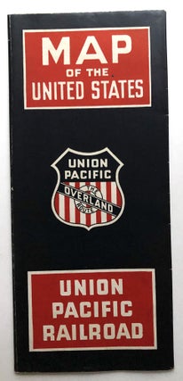
Chicago: Union Pacific RR / Rand McNally, 1938. Folds out to 31 x 18 inches, color map on one side, information on the other about the history and advantages of the Union Pacific Railroad on the other.
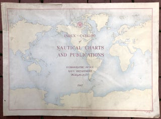
Washington DC: US Navy, Government Printing Office, 1947. Wraps. Self wraps, 27.5 x 20.5 inches, very good, light wear and soil to cover, various paginations, probably 150 color maps. Rare catalog with OCLC locating only 8 holdings.
Chicago: Geographical Publishing Co., 1940. in 9.5 x 7.5 inch mailing envelope with "Julian Bentley's WLS War Map" printed on it. Contains two large folding color maps. The April 1940 War Map is 36 x 27.5 inches, one side showing Europe and Russia and updated news captions in red, the.....
Washington DC: United States Geological Survey, 1896. First printing. Hardcover. Atlas volume only. First edition, 1896. Folio, leather-backed boards with red leather label on front cover, heavily illustrated, Poor copy, covers and flyleaves detached but present, soiling and discoloration to some pages of the text, bookplate, wear to the edges.....
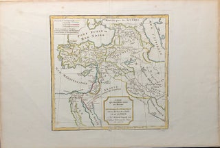
Paris: NP, 1806. Dated 1806 in pencil at bottom of map, we have no reason to doubt this. Sheet measures 18.25 x 12.25 inches, map measures 9.75 x 9.5 inches. Very good, light soil to margins, hand-colored in outline.
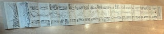
Stockholm: Adolf Huldberg, 1856. Hardcover. A mid-19th century map showing the route from Stockholm to Gothenburg, almost 500 km southeast of Stockholm, charting routes for boats as well as by land. Accordion folded in 24 sections measuring 92 inches (234 cm) x 9 inches (23 cm), most comforming in dimensions.....
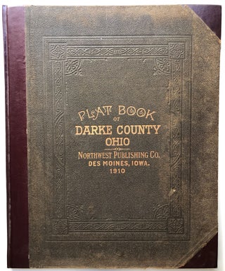
Des Moines, IA: Northwest Publishing Company, 1910. Hardcover. Folio, original cloth boards and half maroon leatherette, new endpapers, contents very good and clean. With 55 pages of county maps, some of which are double-page, all color, double-page color map of Ohio, double-page map of the United States, two hemisphere maps.....
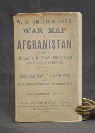
London: W. H. Smith and Son, 1878. Paperback. 1878. Fold-out map, measures 34.5 inches wide x 22.5 inches tall (88 x 57 cm). Full color. Large map showing Afghanistan and surrounding territories, plus two inset maps: one of the Khyber Pass, and one showing the large area between England and.....
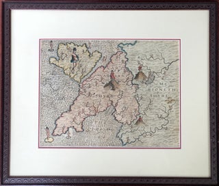
A map from Drayton's "Poly-Olbion" published in 1612, with presumably contemporary hand coloring, 13 x 10 inches visible, handsomely double-matted, framed and glaze, to archival standards; not examined outside of frame. Shows the NW of Wales. Frame measures 20 x 17 inches.
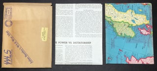
(NY): 1936. Undated but most people date this 1936, a premium for the radio show. Approximately 19 x 24 inches, very good, lightest wear, usual folds.
Winnipeg, Manitoba, Canada: Department of Industry and Commerce, 1960. Paperback. 1960. Paperback, folio in red wraps. 81pp. with 37 plates of full color maps and illustrations, plus a laid in letter from the contemporary Deputy Minister of Commerce, R. E. Grose. Near fine, with some offsetting and minor shelf wear.....
Chicago: The University of Chicago Press, 2008. First printing. Hardcover. Cloth-backed boards in dust jacket, oblong quarto [11.5" X 11.25"], illustrated in color. Book has handsome boards and tight binding, text clean bright and unmarked. DJ fine.
Madrid: History of Cartography Project, Univ. of Wisconsin, 1993. Loose in Folder. 4 of the 5 parts (lacks #3) of the History of Cartography Project, house din the official folder with string ties. Included are the newsletters, announcement sheets, and 4 limited edition, numbered broadside. Broadsides include poems, one illustrated.....
Chicago: University of Chicago Press, 1987. First printing. Hardcover. First printing, 1987, hardcover with blue cloth boards in dust jacket, quarto, 249pp., illustrated in color and b&w. Book near fine with hint of edgewear to spine ends and corners, binding tight, previous owner's sticker to front flyleaf, otherwise text clean.....
New Haven: Yale University Press, 2001. First edition. Hardcover. First edition, 2001, hardcover, octavo, 231pp., illustrated with a couple of maps. Book fine with previous seller's ISBN sticker to rear board, binding tight, text clean and unmarked. No DJ.